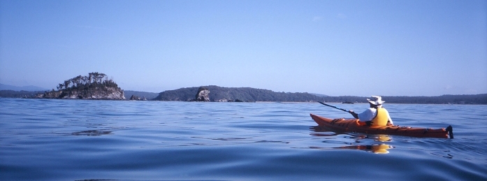
Kayaking Batemans BayFlatwater or sea, paddle away from it all to discover some of the quietest and least touched places in Australia.
Surrounded by Murramarang National Park, Durras Lake is excellent for safe exploring with many tributaries, small exposed areas and shallow bays. As you paddle up the lake you leave the villages behind and become immersed in the wilderness of the spotted gun forest. Launch at the end of Lakeside Drive, South Durras or at the end of North Durras Road, North Durras - continue down to the lake to an informal boat ramp. A circumnavigation could be up to 15km. No toilet facilities at either launch point. Length: Up to 15km Durras to Batemans Bay in the Batemans Marine Park (sea) An enjoyable 17km sea paddle along a quiet coastline of small beaches and rugged headlands in Murramarang National Park. As you come past Wasp Island you will pick up the open sea conditions. The geology here is fantastic – you’re at the south end of the Sydney Sandstone Basin dating back to between 200 and 300 million years. That’s 200 million years younger than the Wagonga formation which you will see emerging as you pass Dark Beach. As you round the headland north of Richmond Beach take a minute to appreciate the magnificent upward arching fold in the cliff face. Most beaches face south east and have powerful dumping surfs if a southerly swell is up. Safer landings can be found once you enter Batemans Bay. Richmond Beach is the easiest beach for landing on route. Launch at the boat ramp at Cookies Beach off Banyandah Street, South Durras or the boat ramp at Old Punt Road on the north-western side of Batemans Bay Bridge. Or for a shorter option, finish at Maloneys Beach. BBQ/picnic area and toilets at Cookies Beach. Length: 17km Cullendulla Creek and Snapper Island (flatwater and sea) Launch from the protected beach at Surfside and paddle around the point to Cullendulla Creek. Exploration of this creek is recommended on higher or between tides. Land and take a short walk on the Cullendulla Nature Reserve boardwalk with interpretive signage about the Aboriginal history. The remains of the historic timber railway near the upper end of the creek are worth seeing. Paddle to Square Head and around Snapper Island, note that the island is a nature reserve and landings are not permitted. Distance is dependent on which route but a return trip may be approximately 14kms. Parking at Surfside beach. Length: Up to 14km The Lower Clyde River – Batemans Bay and Nelligen (flatwater) An expansive river famous for its oysters and surrounding national park. Launch into shallow water near the boat ramps north and south of the west side of Batemans Bay Bridge. For a 15km one-way paddle head up to Nelligen. You will pass the Clyde River National Park’s Big and Little Island, with landing spots on both their southern shores, to land at the little beach downstream of the western boat ramp at Nelligen. Buckenbowra River is worth a side trip if time allows. Check the tides and watch for strong tidal flows. The river bar downstream of the Batemans Bay Bridge should be avoided. Picnic tables and toilets at the southern boat ramp in Batemans Bay and at Nelligen. Length: Up to 30km The Upper Clyde River at Shallow Crossing (flatwater) From Nelligen the Clyde River snakes 25km to the tidal limit at Shallow Crossing. Explore the tributaries and be prepared to cross shallow water spots and pebble races. Launch spots either side of the causeway at the privately owned campground at Shallow Crossing. Paddle another 10 to 15km up this lush, freshwater section depending on water level, flows and accessibility. Expect to experience shallow water, small rapids and trees across the river. If the water levels are high, drive up River Road to Brooman and launch from there for a worthwhile one-way trip down the river to Shallow Crossing. Length: 25-40km Batehaven to Mossy Point (sea) A 20km sea paddle with options for shorter trips. Launch at Corrigans Beach and follow the coastline south east keeping a safe distance from the rocky cliffs. Follow headlands and sheltered bays to Mosquito Bay with a landing option at the protected boat ramp. From here conditions are subject to weather and the next stage should only be attempted by experienced groups in kind weather. The paddling becomes more spectacular as you round Pretty Point and Jimmies Island and there is a sheltered landing point at Guerilla Bay. The next stage is committing and should only be attempted with the right conditions, group and craft. Burrewarra Point, protected by a lighthouse and high cliffs, has secluded beaches, reefs and islets. Rounding the protruding point is the climax of this journey. As you head west, the mountains and beaches offer protection from northerly weather patterns. Explore Barlings Island then head to Camel Rock and the entrance of the Tomaga River. The river bar is only navigable in small swell. A trip of this kind is not to be attempted in rough weather or wind. Boat ramps, parking and toilets at Corrigans Beach, Mosquito Bay and Mossy Point, and parking and launch point at Guerilla Bay. Length: Up to 20km
|
More informationGuided Kayak Tours & kayak hire- all destinations, sea and flatwater kayaking Kayak & Canoe on site / hire only
Accommodation offering kayak / canoe hire
More Kayaking Routes & Maps
|
